Within Rhode Island UFOs
Why Rhode Island's Coast Makes UFOs Harder
Rhode Island's shorelines create many sincere but hard-to-judge reports where boats, aircraft and offshore lights can look strange.
On this page
- Block Island, Newport and Narragansett Bay reports
- Why distance and darkness distort coastal sightings
- What evidence would make a shoreline report stronger
Page outline Jump by section
Introduction
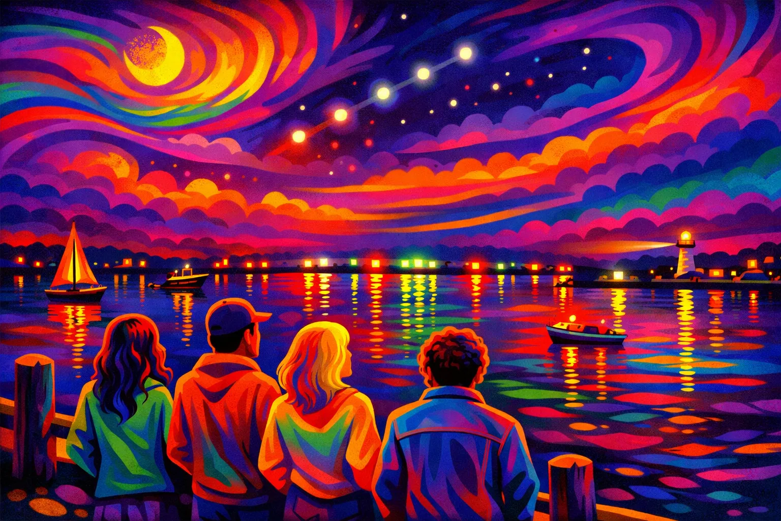
Rhode Island’s coast makes UFO reports both more common and harder to judge. A witness on a beach, ferry route, headland or harbour road may be looking across water towards aircraft, fishing vessels, ferries, buoys, lighthouses, offshore structures, military or research traffic, and lights on distant towns. At night, those objects can lose scale and context. A light that is actually miles away can seem low, near or hovering; a vessel or aircraft travelling towards the viewer can seem stationary; and several unrelated lights can appear to form one object. The result is not that Rhode Island coastal UFO reports should be dismissed. It is that their strongest clue is often also their weakest point: the witness’s estimate of distance, height, size and speed. NUFORC’s Rhode Island index includes coastal or bay-linked reports from places such as Block Island, Newport, Portsmouth, Weekapaug, Narragansett, Jamestown and Westerly, but many entries remain brief witness accounts rather than fully testable cases.[NUFORC]nuforc.orgReports for State RIReports for State RI
Why the shoreline creates sincere but fragile sightings
A coastal UFO report often begins with a real perception problem rather than a strange object. On land, familiar scale markers help the eye: buildings, roads, trees, hills, streetlights and traffic. Across open water, especially at night, those markers disappear. A bright point may be a boat, aircraft landing light, buoy, offshore platform light, planet, drone, helicopter or reflection, but the witness has little help in judging whether it is close and small, or distant and large.
Rhode Island’s geography intensifies this. Narragansett Bay is not an empty backdrop. NOAA’s Coast Pilot describes the bay as the approach to Newport, Providence, Fall River and Taunton, with marked channels, islands, passages, lighthouses, buoys, traffic separation arrangements and numerous fishing and yachting centres. It also notes that navigation can be easy by day or night in clear weather because the bay is “well marked by navigational aids”. Those aids are useful to mariners, but to a shore observer they also add patterned lights to a dark horizon.[nauticalcharts.noaa.gov]nauticalcharts.noaa.govCPB2 C06 WEBCPB2 C06 WEB
The offshore waters south of Rhode Island add another layer. The Ocean Special Area Management Plan describes the wider Rhode Island offshore area as a crossroads between Narragansett Bay, Long Island Sound, Buzzards Bay and Vineyard Sound, used by cargo ships, tankers, tug and barge units, passenger ferries, naval vessels, research craft, enforcement vessels, search-and-rescue vessels and pilot boats. That is exactly the sort of mixed traffic environment in which an unusual light can be both genuinely puzzling and entirely ordinary once plotted against vessel tracks or aviation activity.[Rhode Island Sea Grant]seagrant.gso.uri.eduRhode Island Sea Grant Microsoft WordRhode Island Sea Grant Microsoft Word
Block Island, Newport and Narragansett Bay reports
The most useful way to read Rhode Island’s coastal UFO record is not as one grand mystery, but as a cluster of reports shaped by where the witness was standing. NUFORC lists a 1993 Block Island report summarised as “time loss and multiple objects”, a 1998 Newport report of two yellow lights with “no vertical movement” over a long viewing time, a 1976 Weekapaug report of three globular lights in triangular formation, and several later reports from Narragansett, Newport and nearby bay communities. These reports matter because they show a recurring state pattern: lights seen over or near water, often at night, often described with confidence but without the corroborating data needed to fix range or altitude.[NUFORC]nuforc.orgOpen source on nuforc.org.
One vivid Narragansett Beach report from 2009 shows the problem especially clearly. The witness described a “tiny boomerang” with five greenish-blue lights, first appearing to hover “many miles offshore” while looking towards Newport, then seeming to accelerate towards the observers, grow in apparent size, pass overhead, pivot, and shoot back out over the ocean. The account is striking, but its drama depends heavily on perceived distance and size: “many miles offshore” becomes “almost directly overhead” and then an estimated 100 yards wide. Without video, flight data, exact bearing, weather, lens metadata, radar, or independent observers at another location, there is no reliable way to separate an extraordinary manoeuvre from a mistaken range-and-scale judgement.[NUFORC]nuforc.orgOpen source on nuforc.org.
A different kind of coastal uncertainty appears in a NUFORC report from the ocean’s edge describing a very bright amber circle just above the horizon. The observers initially considered whether it was an aircraft headlight coming towards them, then noted that it seemed stationary and slowly faded. The report is valuable precisely because it preserves the witness’s reasoning: the observers were trying to compare the light with aircraft, other distant travelling lights, and the horizon. It also shows the interpretive trap. “Stationary above the horizon” is one of the hardest coastal observations to assess because aircraft, vessels, celestial objects and fixed maritime lights can all produce a similar first impression.[NUFORC]nuforc.orgOpen source on nuforc.org.
Newport reports add another complication: the bay’s military and aviation context. A 2021 NUFORC Newport entry described a large, low, hovering disk-like object with blue-white lights and an apparent position near local landmarks, including the hospital and Newport naval area. The witness’s account is strongly worded and clearly sincere, but it also depends on estimates made from a moving car at night: low altitude, size, hovering, outline and relative position. Those are precisely the details most vulnerable to perspective error when lights are seen against a dark sky with few fixed references.[NUFORC]nuforc.orgOpen source on nuforc.org.
Why distance and darkness distort coastal sightings
The central mechanism behind many coastal UFO reports is simple: at night, brightness is not distance. A small bright light close by and a powerful light miles away can look deceptively similar. If the light is isolated over water, the brain may infer motion, size and speed from incomplete clues.
Aviation safety sources describe the same problem in practical terms. The Federal Aviation Administration explains the autokinetic illusion: when a person stares at a fixed single point of light, such as a ground light or star, in a dark and featureless background, it can appear to move. SKYbrary gives the same basic explanation, noting that motion perception is relative and that, without reference points, the movement of a single point becomes undefined.[Federal Aviation Administration]faa.govFederal Aviation Administration Spatial DFederal Aviation Administration Spatial D
Rhode Island’s coast supplies the perfect setting for that illusion. A person standing at Narragansett, Point Judith, Newport, Jamestown, Watch Hill or Block Island may see a lone light against sea and sky. If it brightens, dims, changes angle, passes behind haze, or is joined by other lights, the witness may reasonably experience it as approaching, retreating, hovering or accelerating. That is not foolishness. It is normal perception under poor conditions.
Several recurring misreadings are especially relevant:
- Approach illusion: an aircraft, vessel or bright light moving roughly towards the observer may appear stationary for a long time, then suddenly seem to change size or position.
- Formation illusion: separate lights on vessels, aircraft, buoys or shore installations can appear to belong to one large triangular or boomerang-shaped object.
- Horizon compression: lights at different distances can seem to sit on the same flat line above the water.
- Scale inflation: once a witness decides a light is “far offshore”, any apparent movement or brightness change can imply enormous speed or size.
- Featureless-background motion: a stationary or slow-moving light can appear to wander if the observer stares at it without nearby visual references.
The point is not that every coastal report has a mundane answer. It is that many reports cannot be fairly judged unless the distance claim is independently checked. A UFO report that says “it was 100 yards wide” is much stronger if that size comes from triangulation or a known nearby reference, and much weaker if it comes from estimating the size of a light first assumed to be miles away.
Boats, buoys, wind turbines and offshore lights
Rhode Island’s marine environment contains many lights that are meant to be noticed. BoatUS explains that navigation lights are required at night and in reduced visibility, and that they communicate a vessel’s size, activity and direction of travel. To a trained mariner, red, green, white, yellow and blue lights have rule-based meanings; to a beach observer, they may simply look like coloured lights moving strangely over the water.[The BoatUS Foundation]boatus.orgThe Boat US Foundation Navigation LightsThe Boat US Foundation Navigation Lights
The U.S. Coast Guard’s Light List shows how structured and varied this lighting environment is. It lists seacoast lights, secondary lights, sound signals, river and harbour lights, lighted buoys, daybeacons and other aids to navigation. It also explains that aids to navigation are meant to be read with nautical charts, because their purpose depends on their relationship to channels, hazards and other markers. A witness without that chart context may see the same lights as irregular, hovering or oddly patterned.[Navigation Center]navcen.uscg.govNavigation Center
Offshore wind has added a modern source of coastal lights. The Block Island Wind Farm, the first commercial offshore wind farm in the United States, began commercial operation in December 2016 and consists of five turbines about 3.8 miles from Block Island. It is a known, fixed source of offshore structures and lighting in Rhode Island waters, not a UFO explanation for older reports, but relevant to newer shoreline observations where witnesses see unusual lights offshore.[Tethys]tethys.pnnl.govTethys Block Island Wind Farm | TethysTethys Block Island Wind Farm | Tethys
The Coast Guard also notes that lights and sound signals on offshore structures are private aids to navigation and may not always appear in the main Light List unless they meet certain criteria. Offshore structures can be marked by quick flashing white, red or yellow lights, and wind farm structures follow specific lighting and marking guidance. This matters for UFO interpretation because a witness can be looking at a real, regulated, unfamiliar light source without knowing what it is.[Navigation Center]navcen.uscg.govNavigation Center
What would make a shoreline report stronger
The weakest coastal UFO reports are not weak because the witness is unreliable. They are weak because the setting makes the key claims hard to test. A single light over water, seen at night from one location, can rarely establish distance, size or speed. A strong Rhode Island shoreline report would therefore need evidence that reduces ambiguity rather than simply intensifying the description.
The most useful evidence would be:
- Exact location and viewing direction: a beach name is useful, but a precise spot, compass bearing and angle above the horizon are much better.
- Time to the minute: this allows comparison with aircraft tracking, ferry schedules, marine traffic, satellite passes, weather observations and astronomical objects.
- Multiple separated witnesses: two people beside each other confirm that something was seen; witnesses at different locations help triangulate where it was.
- Video with context: footage should include the horizon, fixed landmarks, streetlights, shoreline features or stars, not just a zoomed bright dot.
- Unedited metadata: original phone or camera files can preserve time, lens, exposure and sometimes location data.
- Environmental checks: tide, fog, haze, cloud, moon, wind direction and visibility can all affect how far lights carry across water.
- Traffic comparison: marine AIS data, ferry routes, airport activity, helicopter operations and known military or research activity can turn a mystery into a testable case.
NASA’s independent UAP study team made a broader version of the same point: despite many accounts and images, UAP analysis is limited by a lack of high-quality observations. That applies strongly to Rhode Island coastal reports. The issue is usually not whether a witness saw something; it is whether the record contains enough information to distinguish an anomalous object from ordinary coastal traffic, optics or perception error.[NASA Science]science.nasa.govScience Independent Study Team ReportScience Independent Study Team Report
How this changes Rhode Island’s UFO history
Coastal ambiguity should not be treated as an embarrassment to Rhode Island’s UFO record. It is one of the record’s defining features. The state’s small size, busy shoreline, island views and bay traffic mean that UFO history here is less about dramatic desert encounters and more about how ordinary people interpret difficult lights in an unusually complex coastal setting.
That also helps explain why places such as Narragansett and Newport appear in UFO datasets without becoming firm landmark cases. A 2024 local ranking using NUFORC data listed Narragansett with 16 reports and Newport with 18, while larger population centres such as Warwick, Providence and Cranston had higher totals. Those numbers are best read as reporting patterns, not proof of anomalous activity; they show where people report sightings, not where extraordinary objects have been verified.[What's Up Newp]whatsupnewp.comWhat's Up Newp Cities with the most UFO sightings in Rhode IslandWhat's Up Newp Cities with the most UFO sightings in Rhode Island
For readers following Rhode Island’s wider UFO history, coastal cases are therefore a useful caution. They preserve sincere testimony from beaches, bays, islands and harbour roads, but they also show why “it looked close”, “it hovered”, “it was huge” and “it shot away” need careful handling. In a shoreline setting, those phrases may describe an extraordinary event, or they may describe how the human eye and brain handle a distant light with too few reference points. The fairest conclusion is neither dismissal nor belief on demand: Rhode Island’s coastal sightings are worth recording, but the best cases are the ones that turn a strange light over water into a measurable event.
Amazon book picks
Further Reading
Books and field guides related to Why Rhode Island's Coast Makes UFOs Harder. Use these as the next step if you want deeper reading beyond the article.
The Report on Unidentified Flying Objects
Discusses recurring patterns in sightings and investigations.
The Demon-Haunted World
Rating: 4.5/5 from 43 Google Books ratings
Useful for assessing uncertain visual observations.
eBay marketplace picks
Marketplace Samples
Example marketplace items related to this page. Use the search link to explore similar finds on eBay.






Endnotes
1.
Source: nuforc.org
Title: Reports for State RI
Link:https://nuforc.org/subndx/?id=lRI
2.
Source: nauticalcharts.noaa.gov
Title: CPB2 C06 WEB
Link:https://nauticalcharts.noaa.gov/publications/coast-pilot/files/cp2/CPB2_C06_WEB.pdf
3.
Source: nuforc.org
Link:https://nuforc.org/sighting/?id=68466
4.
Source: nuforc.org
Link:https://nuforc.org/sighting/?id=50978
5.
Source: nuforc.org
Link:https://nuforc.org/sighting/?id=162174
6.
Source: skybrary.aero
Title: Autokinetic Effect | SKYbrary Aviation Safety
Link:https://skybrary.aero/articles/autokinetic-effect
7.
Source: boatus.org
Title: The Boat US Foundation Navigation Lights
Link:https://boatus.org/study-guide/navigation-maneuvering/navigation-lights/
8.
Source: navcen.uscg.gov
Title: Navigation Center
Link:https://www.navcen.uscg.gov/sites/default/files/pdf/msi/LightList_V1_2024.pdf
9.
Source: science.nasa.gov
Title: Science Independent Study Team Report
Link:https://science.nasa.gov/wp-content/uploads/2023/09/uap-independent-study-team-final-report.pdf
10.
Source: nuforc.org
Link:https://nuforc.org/sighting/?id=122416
11.
Source: nuforc.org
Link:https://nuforc.org/sighting/?id=183087
12.
Source: nuforc.org
Link:https://nuforc.org/sighting/?id=54754
13.
Source: nuforc.org
Link:https://nuforc.org/map/
14.
Source: nuforc.org
Link:https://nuforc.org/
15.
Source: nuforc.org
Link:https://nuforc.org/sighting/?id=120688
16.
Source: nuforc.org
Link:https://nuforc.org/report-a-ufo/
17.
Source: tidesandcurrents.noaa.gov
Link:https://tidesandcurrents.noaa.gov/ports/index.html?port=nb
18.
Source: atsb.gov.au
Link:https://www.atsb.gov.au/sites/default/files/2024-05/FAA-H-8083-3B%20Chapter%2010.pdf
19.
Source: forecast.weather.gov
Link:https://forecast.weather.gov/shmrn.php?mz=anz236
20.
Source: seagrant.gso.uri.edu
Title: Rhode Island Sea Grant Microsoft Word
Link:https://seagrant.gso.uri.edu/oceansamp/pdf/samp_approved/700_marinetrans_OCRMchanges_5.4_Clean.pdf
21.
Source: faa.gov
Title: Federal Aviation Administration Spatial D
Link:https://www.faa.gov/pilots/safety/pilotsafetybrochures/media/spatiald_visillus.pdf
22.
Source: tethys.pnnl.gov
Title: Tethys Block Island Wind Farm | Tethys
Link:https://tethys.pnnl.gov/wind-project-sites/block-island-wind-farm
23.
Source: whatsupnewp.com
Title: What’s Up Newp Cities with the most UFO sightings in Rhode Island
Link:https://whatsupnewp.com/2024/11/cities-with-the-most-ufo-sightings-in-rhode-island/
24.
Source: sentientorbs.com
Title: NUFORC 68466
Link:https://sentientorbs.com/explore/sightings/NUFORC-68466
Additional References
25.
Source: faa.gov
Link:https://www.faa.gov/sites/faa.gov/files/regulations_policies/handbooks_manuals/aviation/airplane_handbook/12_afh_ch11.pdf
26.
Source: newshorehamri.gov
Link:https://newshorehamri.gov/426/Block-Island-Offshore-Wind-Project
27.
Source: boem.gov
Link:https://www.boem.gov/renewable-energy/state-activities/appendix-k-references-cited
28.
Source: faasafety.gov
Link:https://www.faasafety.gov/files/events/SO/SO15/2024/SO15134204/YourSensesInTheShadows.pdf
29.
Source: youtube.com
Title: The SHOCKING Math Error Behind Viral UFO Videos | Mick West
Link:https://www.youtube.com/watch?v=ypfbhfEXnBo
Source snippet
How To Geolocate and Identify a Typical Tic-Tac UFO...
30.
Source: youtube.com
Title: Eystein Eye’s Optical Illusions
Link:https://www.youtube.com/watch?v=DI9j6ISwLUE
Source snippet
UFO Videos Explained: Mick West's Expert Analysis...
31.
Source: war.gov
Title: department of defense releases the annual report on unidentified anomalous phen
Link:https://www.war.gov/News/Releases/Release/Article/3964824/department-of-defense-releases-the-annual-report-on-unidentified-anomalous-phen/
32.
Source: facebook.com
Link:https://www.facebook.com/TimesofIndia/videos/a-privatejet-pilot-flying-over-rhodeisland-reported-a-bizarre-encounter-with-a-s/1956134165330066/
33.
Source: facebook.com
Link:https://www.facebook.com/toiworldnews/videos/a-privatejet-pilot-flying-over-rhodeisland-reported-a-bizarre-encounter-with-a-s/1357292832217707/
34.
Source: facebook.com
Link:https://www.facebook.com/ProvidenceJournal/posts/a-ufo-was-recently-reported-near-warren-rhode-island-how-many-other-sightings-ha/1407735110930066/
Topic Tree